For access to the database click here “Stednavne”.
East Greenland Place Names is a (Danish language) data base with place names given to places in East Greenland by the first travelers and expeditions as part of their contribution to the mapping of the coast of East Greenland.
The data base includes place names given up to our time, however, it is our intention only to continue the systematic collection of place names up to and inclusive of "The Bicentenary Jubilee Expedition around the North of Greenland 1920-23" (Lauge Koch).
In this connection East Greenland is bounded widely to be the land east of a line from Cap Farewell in the south and from there in a northerly direction to the bottom of the Lindenow Fiord, and from there still in northerly direction across the Inland Ice to the central line by Adam’s Glacier, J.P. Koch Fiord and Chipp Sound.
The data base includes lists comprising the place names, which were used by the individual expeditions or by their members with connecting introductions, and they are all arranged in a pdf-portfolio, to be opened in order to achieve access to the data base.
The data base is constantly being developed, and a couple of times a year the portfolio will be updated with new lists as well as additions to and corrections of previous lists.
The name place data base works in the best way, if you use use Adobe Reader X or Adobe Reader X or newer. Once downloaded, you can open the file directly or from your folder with downloads, depending on the browser you use.
The portfolio may be used as a book, in which the individual lists and introductions are chapters that you may leaf through, and in which you may search crosswise of the individual chapters.
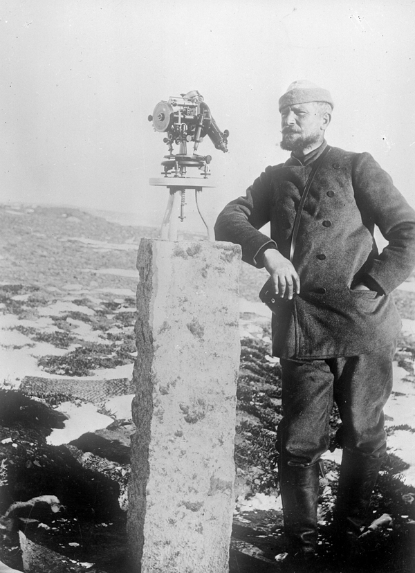
Foto 07430: Kartograf J.P. Koch stående ved granitsoklen med teodoliten, der var udgangspunkt for alt målearbejde i Nordøstgrønland i 1906-08.
Fotograferet af Christian Bendix Thostrup under Danmark-ekspeditionen.